
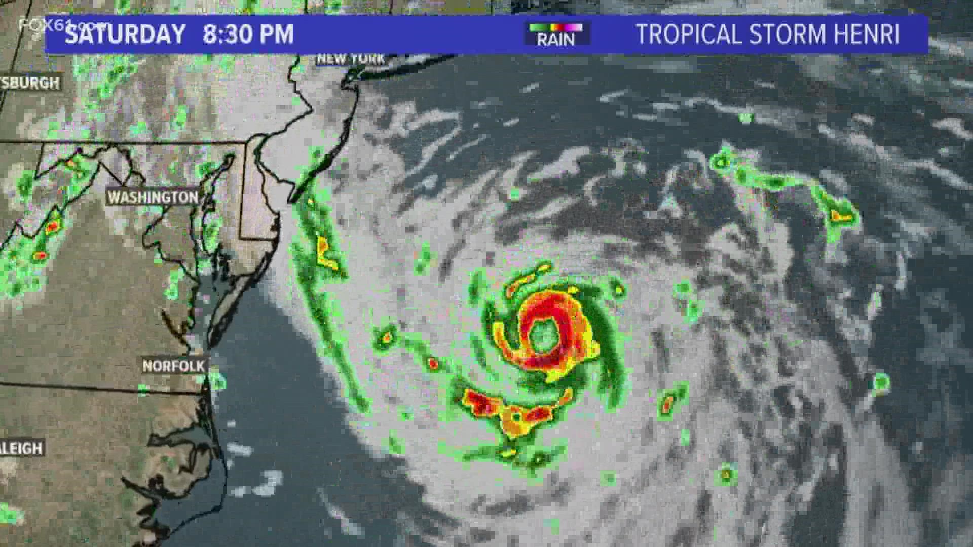
CONNECTICUT, USA — Tropical storm Henri made landfall Sunday at around 12:15 PM, bringing heavy rain and strong winds to the New England area. Ultimately, the storm didn’t quite meet expectations thanks in part to the jet stream.
Most models showed Henri harnessing enough power and force to fight the upper-level high-pressure system that in the end, steered it eastward.

While the storm was expected to remain a Category 1 hurricane when it hit land, the intensity dropped off quickly as colder water off the coast of New Jersey depleted its energy.

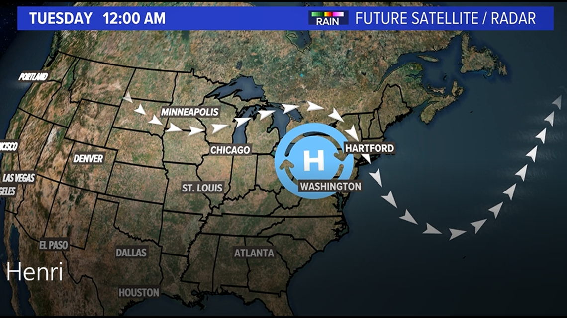
However, we are still dealing with the remnants of Henri. A rare wavy jet stream is almost causing a jam in the atmosphere, stalling out the rain in the New York City region making for a very slow exit.
The worst of Henri has passed, but with the system stalling over our area, we could be seeing an additional inch to an inch and a half here.
Greg Perez is a meteorologist from TEGNA's FOX43, who traveled to Connecticut to help FOX61 News with Henri coverage. Follow him on Twitter, Facebook, and Instagram.
--
HERE ARE MORE WAYS TO GET FOX61 NEWS
Download the FOX61 News APP
iTunes: Click here to download
Google Play: Click here to download
Stream Live on ROKU: Add the channel from the ROKU store or by searching FOX61.