
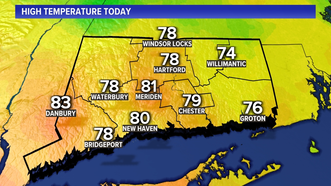
CONNECTICUT, USA — Monday has been warm and even a bit humid! Temperatures will be cooler in the days ahead with a few showers.

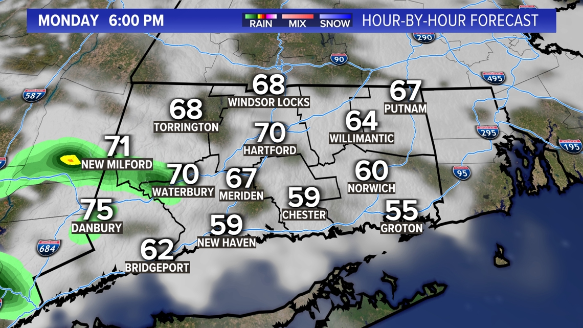
A few scattered showers are likely tonight/overnight. There could be an isolated thunderstorm too.

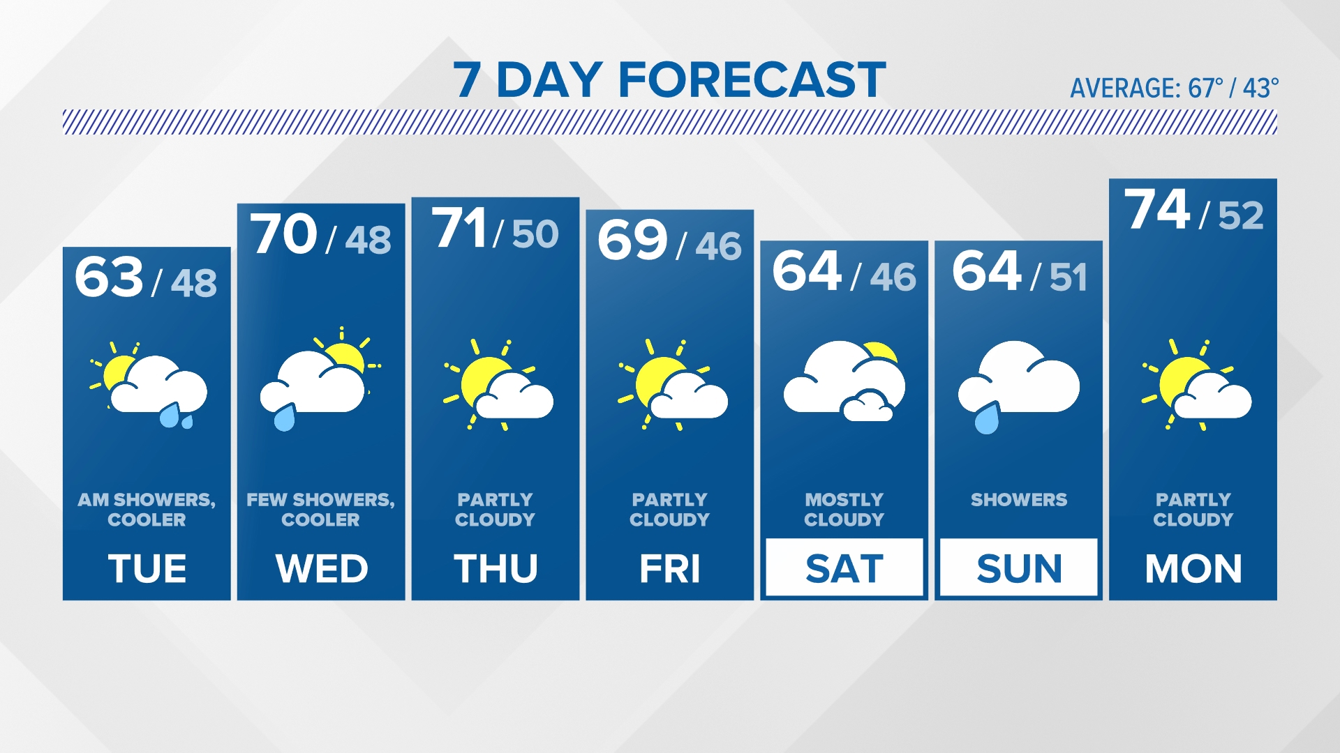
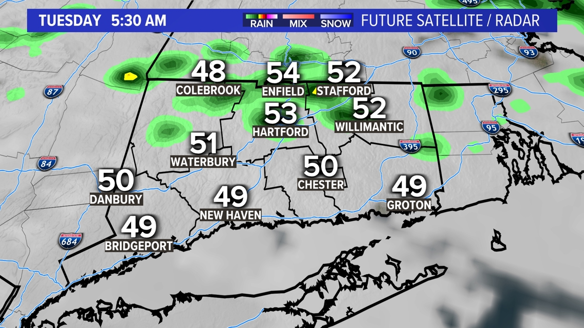
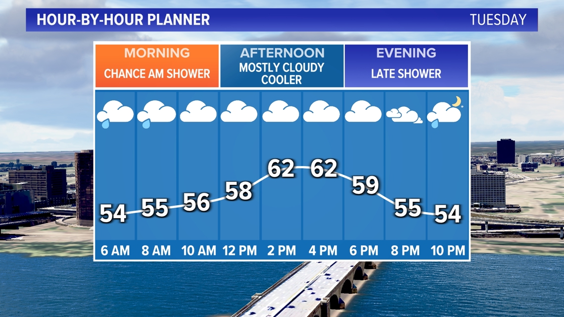
Tuesday will get off to a damp start with a few scattered showers.

There's another chance for showers at night. In between most of the day will be dry but mostly cloudy and cooler.

A few spotty showers are possible on Wednesday but like Tuesday, most of the day will be dry.
Thursday and Friday look brighter and a bit warmer.
There are no big warm-ups or cool-downs in sight after that. No frost in sight!


Forecast Details:
TONIGHT: A few showers possible. Low: Near 50.
TUESDAY: Mostly cloudy, cooler. Chance for a shower early in the day and showers at night. High: 60s.
WEDNESDAY: Mostly cloudy with a few lingering showers. High: Low to mid 60s.
THURSDAY: Partly cloudy. High: Upper 60s shore, low 70s inland.
FRIDAY: Partly cloudy. High: Upper 60s shore, low 70s inland.
SATURDAY: Mostly cloudy. High: Mid to upper 60s.
SUNDAY: Mostly cloudy. High: Mid to upper 60s.
Follow the FOX61 Weather Watch team on Facebook:
And on X (formerly known as Twitter):
Rachel Frank, Matt Scott, Sam Sampieri, Rachel Piscitelli, Ryan Breton
Watch More: Weather Watch