
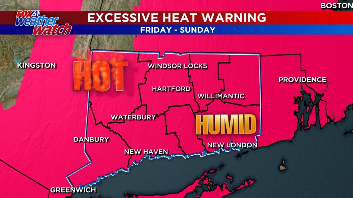
Today through Sunday we're really cranking up the heat and humidity, with "feels like" temperatures near or above 100 degrees. This heat can be dangerous, but only if you're not taking care of yourself. You know what to do!
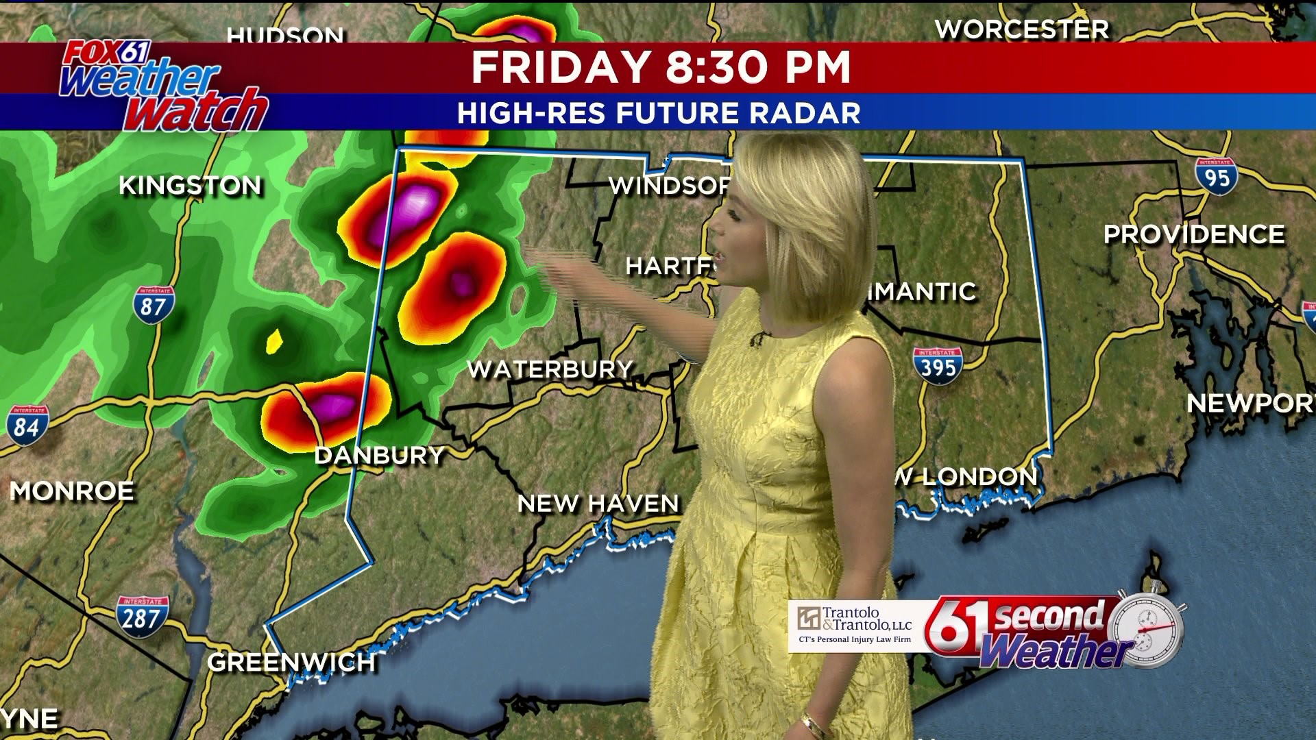
There is a chance for an isolated thunderstorm around sunset tonight. Otherwise it will be very warm and humid with low temperatures only in the mid-upper 70s. That won't help cool off your home if you open the windows.

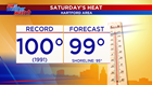
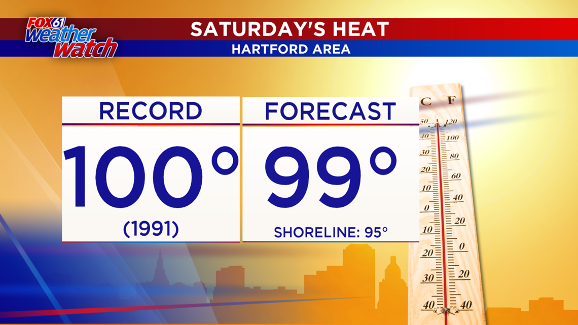
On Saturday, temperatures could approach triple digits inland. If Windsor Locks hits 100 degrees, that would tie the daily record. It would also be the hottest day since 2012!
The excessive heat and humidity continues through Sunday. Once again highs will soar into the mid-90s to near 100 degrees coupled with high humidity. There is another chance for an isolated storm Sunday afternoon. But the cold front that will put an end to the heat and humidity moves through on Monday.
Tuesday we finally lose both the heat and humidity.
FORECAST DETAILS:
TONIGHT: Warm and muggy with partly cloudy skies. Chance for an isolated shower/storm. Lows: 70s.
SATURDAY: Hazy, hot and humid. High temperatures: 94-100. with heat indices 100-115
SUNDAY: Hazy, hot and humid. Chance for a PM storm. Highs: 94-100. with heat indices 100-115
MONDAY: Mostly cloudy, cooler but still humid with scattered showers and storms. High: 80s
TUESDAY: Less humid, finally! Cooler too. Highs: Upper 70s to low 80s.
WEDNESDAY: Partly cloudy, comfy. High: Low-mid 80s.
THURSDAY: Partly cloudy. High: Low-mid 80s.
Follow our weather team on Facebook!
Dan Amarante, Rachel Frank, Matt Scott, Sam Sampieri, Rachel Piscitelli
And on Twitter:
Dan Amarante, Rachel Frank, Matt Scott, Sam Sampieri, Rachel Piscitelli