
Following a scattering of thunderstorms that produced heavy rain and isolated instances of damaging winds on Tuesday in the central United States, AccuWeather meteorologists are expecting a repeat performance on Wednesday.
There will be several areas at risk for showers and thunderstorms on Wednesday. While this is very typical for the summer, some locations will be more prone than others to experiencing the unsettled weather.
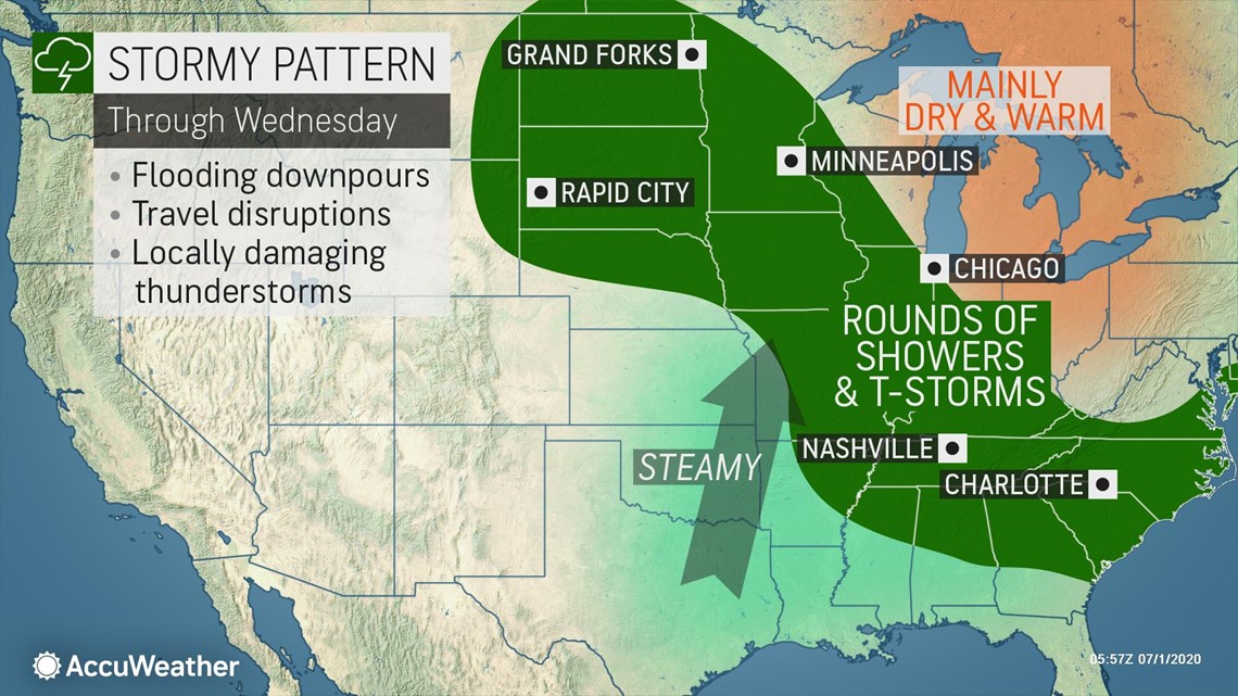
One area will be from the Ohio and Tennessee valleys through portions of the Southeast, targeting cities such as Nashville, Tennessee and Atlanta. In this area, a front that has been stalled for several days will continue to provide a focus for showers and thunderstorms.

The main threat with the storms will be heavy rain with minor ponding on roadways. However, any location in which a storm is slow moving or multiple storms move through, flash flooding will be a concern.
"Numerous rounds of showers and storms will impact parts of Kentucky and Tennessee, once again on Wednesday, raising the flash flood threat across the region," noted AccuWeather Senior Meteorologist Dan Pydynowski.
"For those looking to get some yard work or exercise in during the afternoon or evening hours, heavy downpours and lightning may hinder these plans," Pydynowski continued.
In addition, any storm can produce strong winds. While a few storms could even cause damaging winds, this will be the exception rather than the rule.
However, it is always important to remember that every thunderstorm contains dangerous lightning.
A second area of focus will be in portions of the Upper Midwest, including Minneapolis. As a cold front moves eastward, thunderstorms will form in the vicinity of the front.
With a piece of energy lifting into Canada, the risk for severe weather should be low. However, eastern Manitoba and extreme western Ontario will have some risk for strong winds, as those locations will be closest to the aforementioned energy.
A third section of the country that could have a higher chance for thunderstorms to rumble will be in the Northeast. This will be due to a storm system that has been essentially sitting in the same place all week.
The storm will expand and move slightly westward into Wednesday night. Therefore, while cities such as Williamsport and State College, Pennsylvania, have stayed dry to start the the week, that may not be the case into Wednesday night.

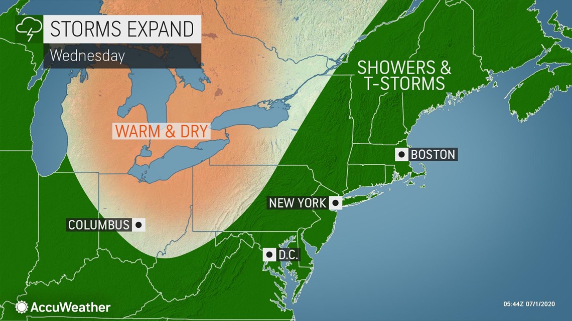
However, areas farther east such as Boston and New York, which have already experienced rain and thunderstorms this week will still have the risk of more active weather on Wednesday. Just like in the other two areas, one or two storms with strong winds will be possible.
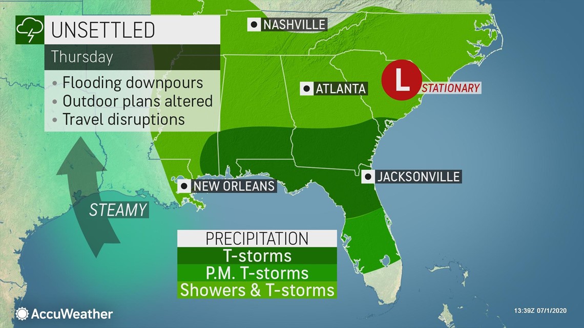
The Northeast is likely to experience a quieter day on Thursday, but parts of the Midwest and Southeast may face storms yet again.
Parts of the middle Mississippi Valley may trend less wet as storms begin to ramp up in coverage and duration in the South.

"Downpours have repeated on a daily and even hourly basis from parts of the Upper Midwest to the middle Mississippi Valley and the Tennessee and lower Ohio valleys in recent days," according to AccuWeather Senior Meteorologist Alex Sosnowski.
Small streams have been spilling out of their banks, streets have turned into rivers and farm fields have become flooded.
"This less-rainy trend should be enough to allow waters in most hard-hit areas of the Midwest to recede, but conditions in the Southeast are likely to get worse with flooding issues forecast to escalate into the weekend," Sosnowski said.
This general area of disturbed weather has the potential to allow a tropical system to slowly brew during next week in adjacent waters of the Gulf of Mexico and the western Atlantic.