
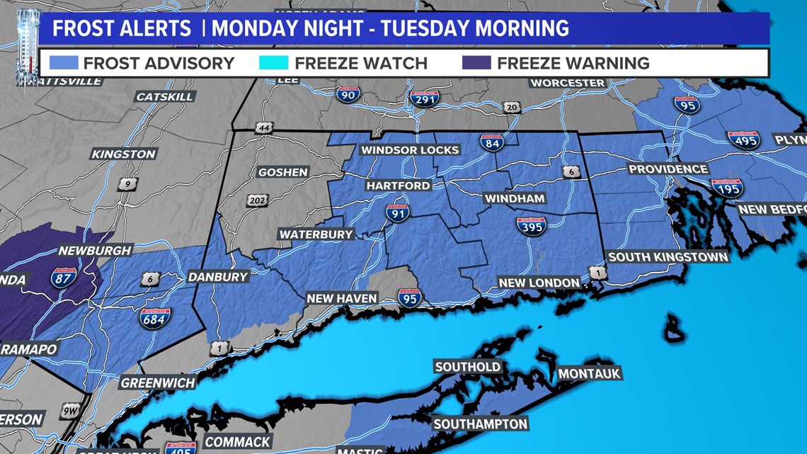
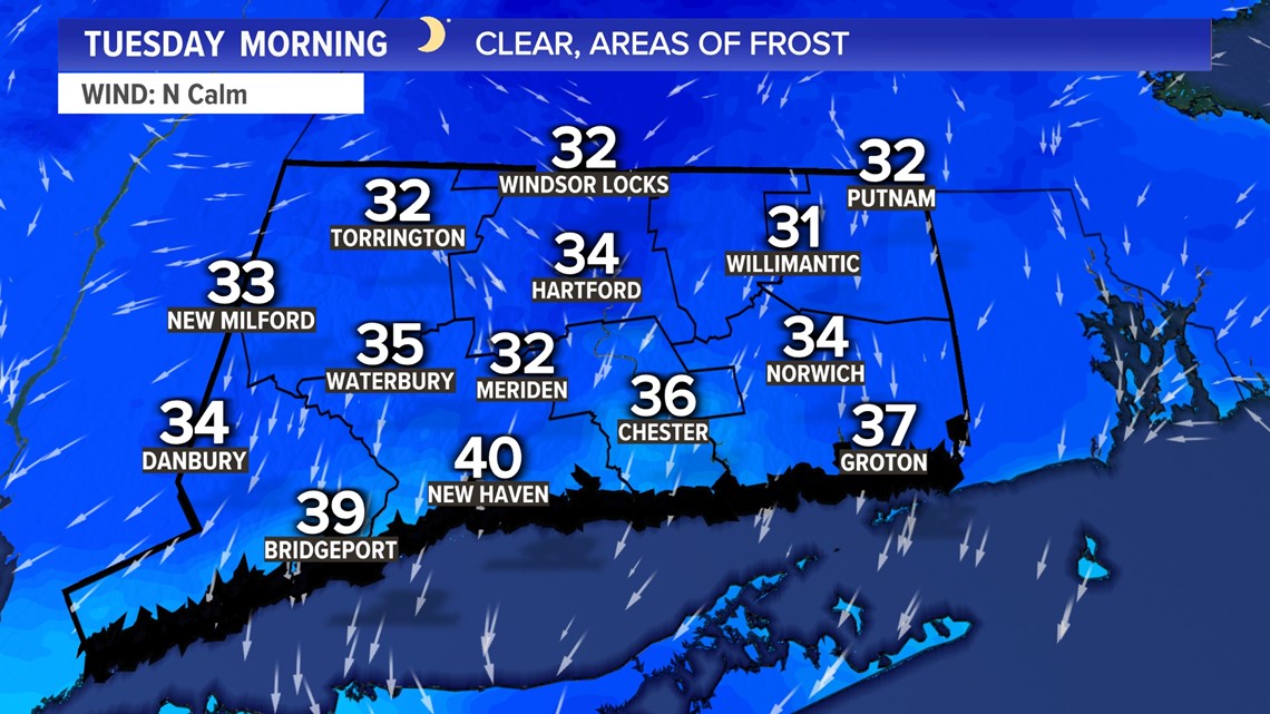
CONNECTICUT, USA — A Frost Advisory is in effect for Monday night into Tuesday morning for most of the state with temperatures dropping into the 30s. Litchfield County will also experience temps near freezing but that part of the state is not issuing frost alerts yet since it's so early in the season.

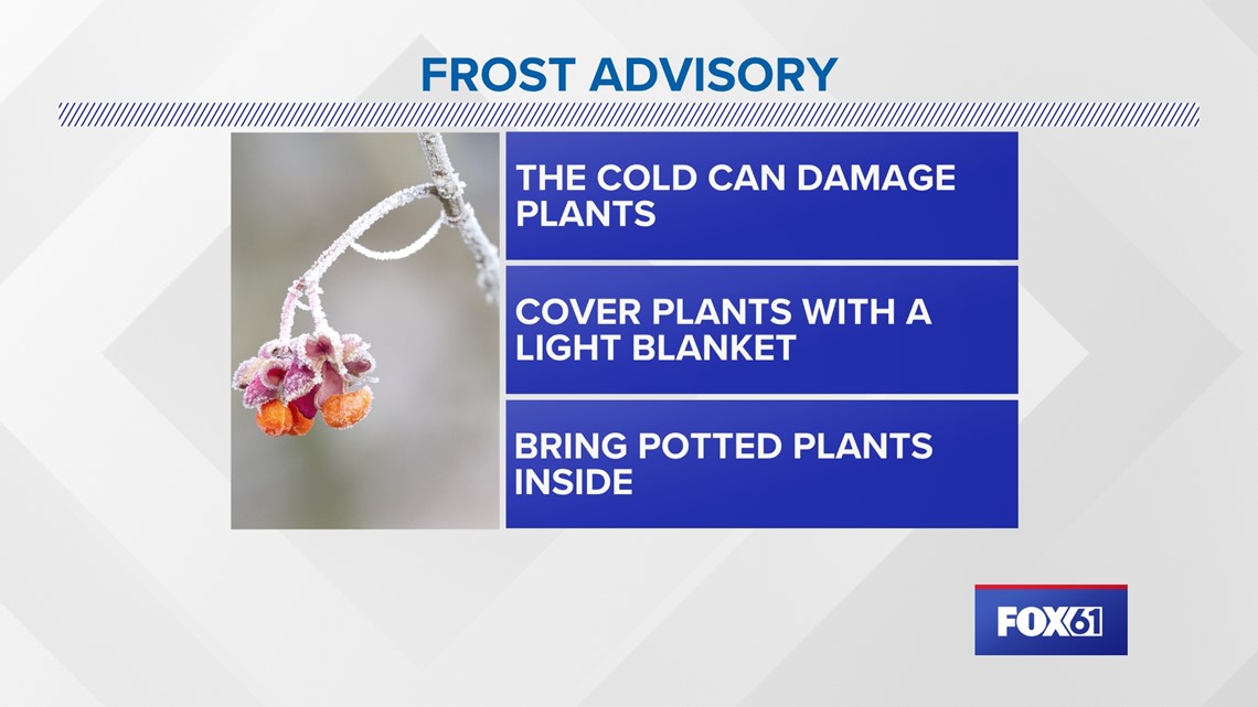
If you have any cold sensitive plants you may want to take steps necessary to protect them tonight.

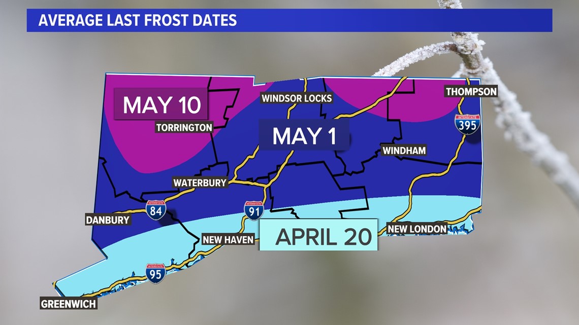
Frost is not unusual this time of year though! Here's a look at the average last frost date.


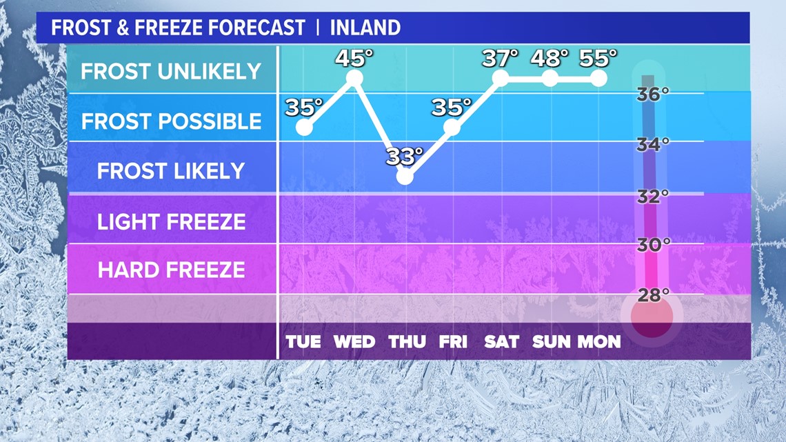
This isn't the only cold night of the week. Frost is possible on several occasions.
Wednesday night into Thursday morning could be even colder with a Freeze Warning possible. This means it could be cold enough to kill early season plants.

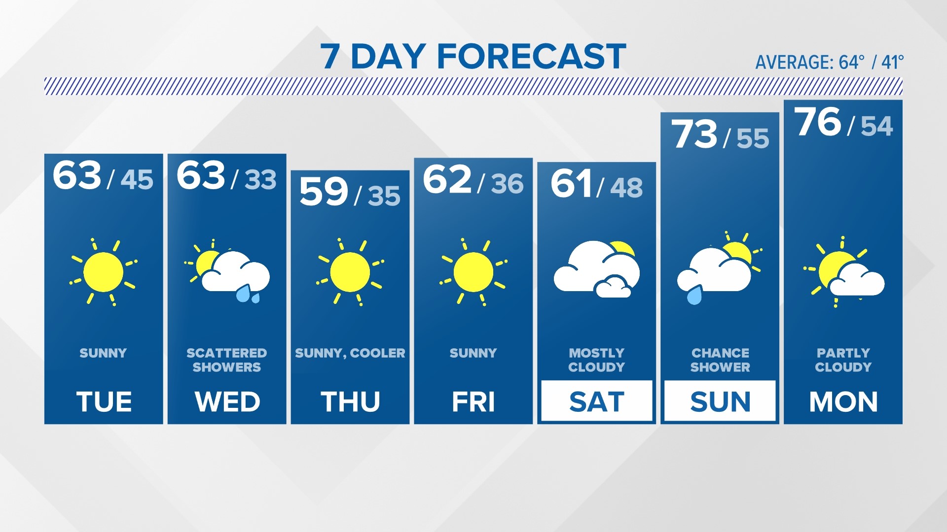
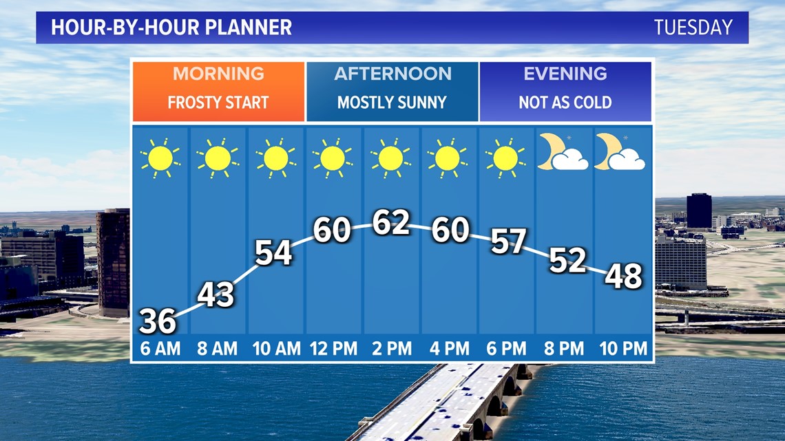
After a cold start to the day on Tuesday, we'll make a nice recovery with afternoon highs in the low 60s under a mostly sunny sky.

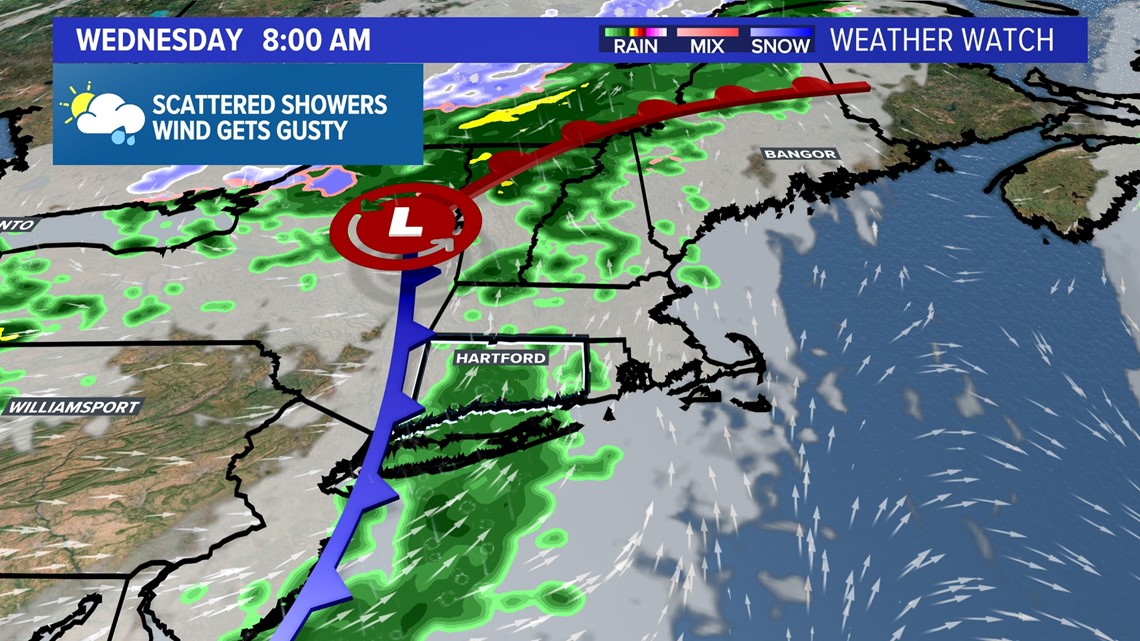
The one system we'll have to deal with this week comes on Wednesday, bringing scattered showers.

Behind this front it will turn cooler and breezy Wednesday night into Thursday. However, both Thursday and Friday look to bring sunshine as high pressure builds in.
As this area of high pressure slips away next weekend. There is a slight chance for showers on Sunday but overall, much of the weekend looks dry.


Forecast Details:
TONIGHT: Patchy frost, cold, clear. Low: 30s.
TUESDAY: Patches of frost in the morning, especially inland. Mostly sunny and a bit milder by afternoon. High: Low 60s.
WEDNESDAY: Mostly cloudy with scattered showers. Breezy. High: Low 60s.
THURSDAY: Mostly sunny, breezy and cooler. High: Mid to upper 50s.
FRIDAY: Sunny and pleasant. A bit milder afternoon. High: Low 60s.
SATURDAY: Sunny to partly cloudy. High: Low 60s.
SUNDAY: Partly to mostly cloudy; chance for showers. High: Low 60s.
Follow the FOX61 Weather Watch team on Facebook:
And on X (formerly known as Twitter):
Rachel Frank, Matt Scott, Sam Sampieri, Rachel Piscitelli, Ryan Breton
Watch More: Weather Watch