
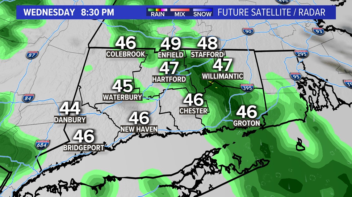
CONNECTICUT, USA — Showers will develop Wednesday evening as a slow-moving front approaches from the west.

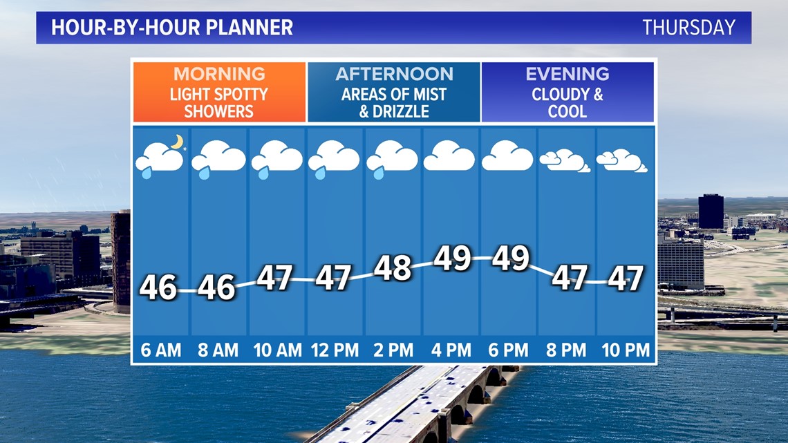
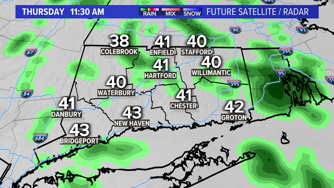
Then showers will linger off and on into Thursday. This system will not bring a lot of rain but the day won't win any beauty contests with cloudy skies, unseasonably cool temperatures and damp conditions. Most of the day will be in the 40s.


At least we're not expecting flooding this time!
Rainfall totals will be within 0.25"- 0.5".
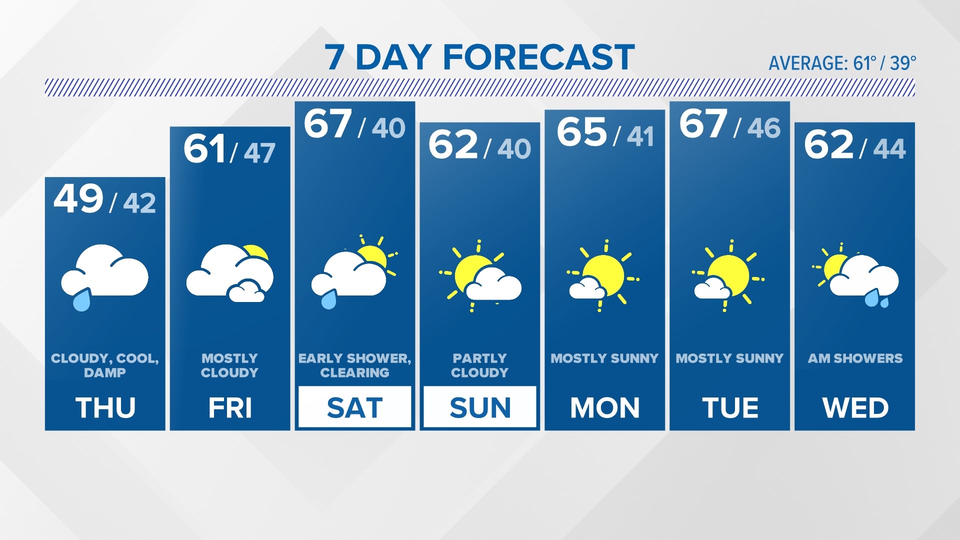
Friday looks mostly cloudy and cool but dry.
The next chance for showers after Thursday will be later Friday night into Saturday morning as a cold front moves through.

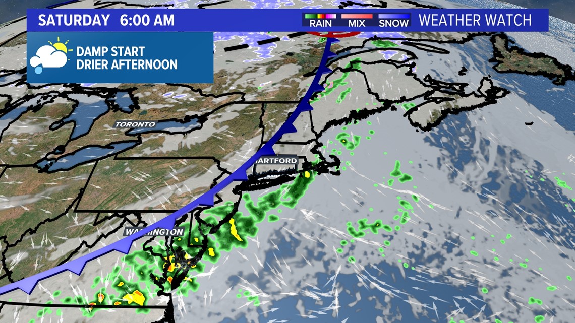
Showers should be over before 8 am on Saturday with weekend improvement.

Forecast Details:
TONIGHT: Showers likely. Low: 40s.
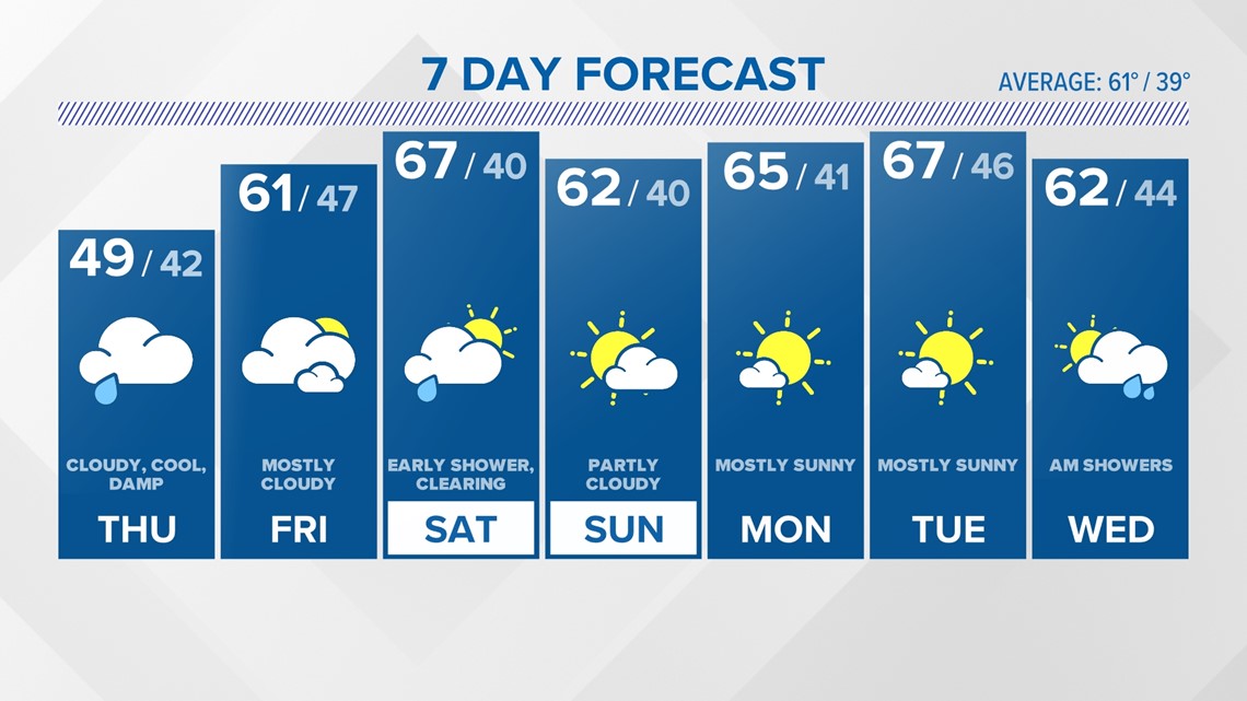
THURSDAY: Cloudy, cool, a few showers. High: 40s - near 50.
FRIDAY: Mostly cloudy. High: Mid-upper 50s.
SATURDAY: Chance for an early shower. Partly cloudy. High: Low-mid 60s.
SUNDAY: Partly cloudy. High: Near 60.
MONDAY: Mostly sunny. High: Mid 60s.
TUESDAY: Mostly sunny. High: Mid-upper 60s.
Follow the FOX61 Weather Watch team on Facebook:
And on X (formerly known as Twitter):
Rachel Frank, Matt Scott, Sam Sampieri, Rachel Piscitelli, Ryan Breton
Watch More: Weather Watch