
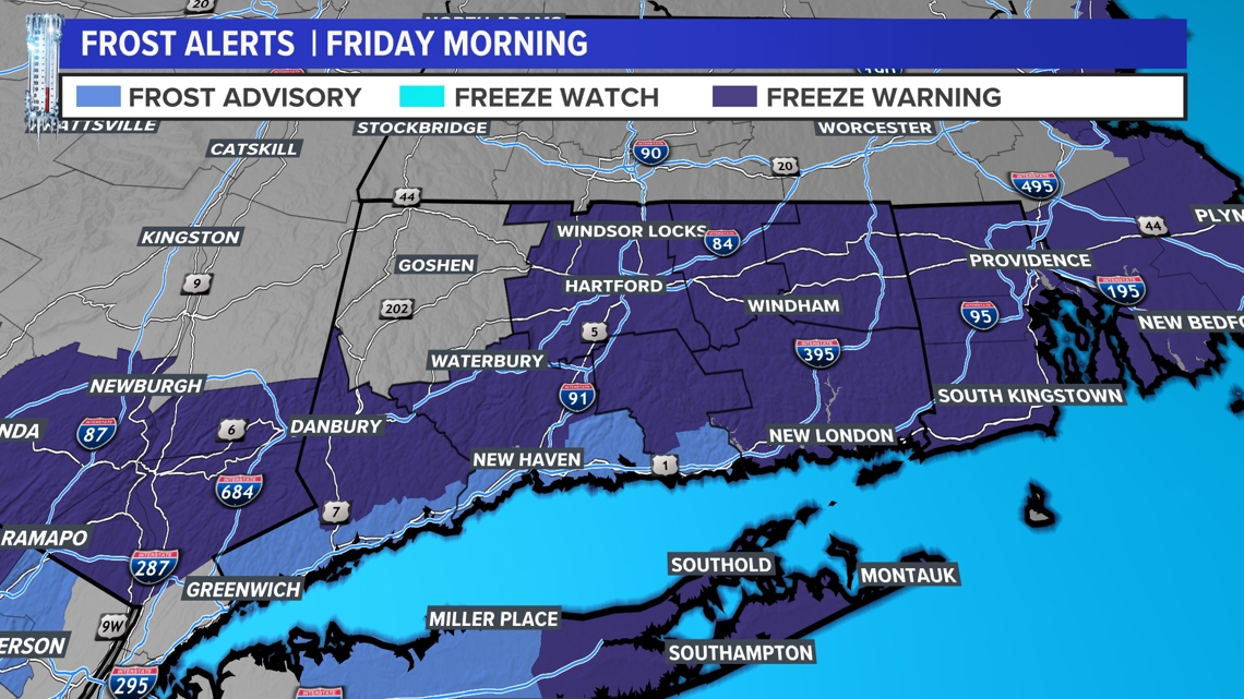
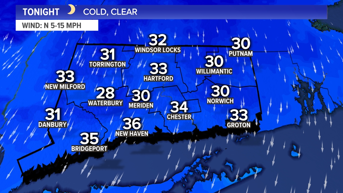
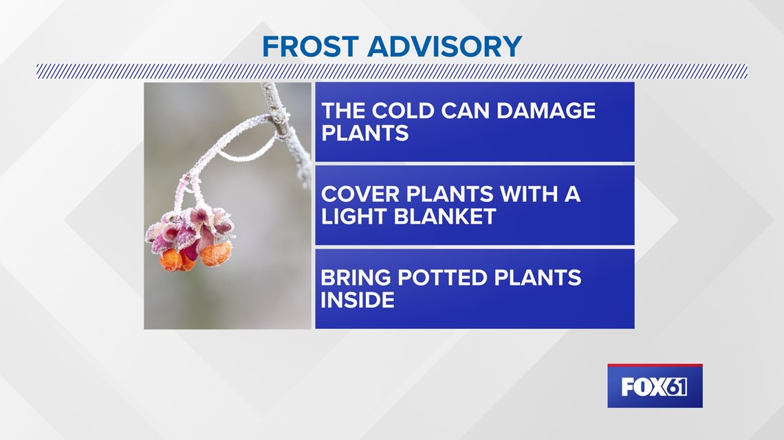
CONNECTICUT, USA — Thursday night into Friday morning, inland Connecticut is back under a Freeze Warning. Temperatures are expected to fall near freezing again. The shoreline is under a Frost Advisory where temperatures will not drop below freezing but the cold can still damage early season plants.


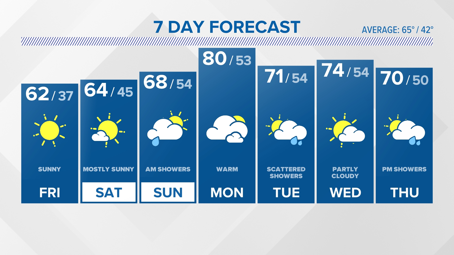
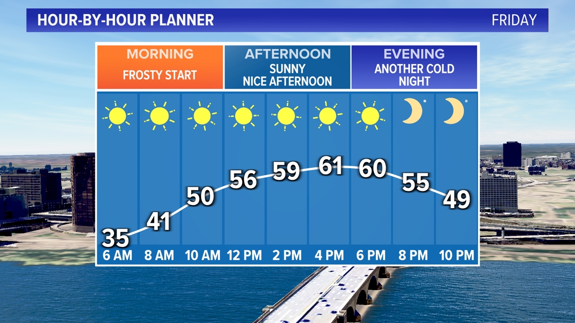
Wall to wall sunshine is expected again for Friday with temperatures a bit below average by afternoon.

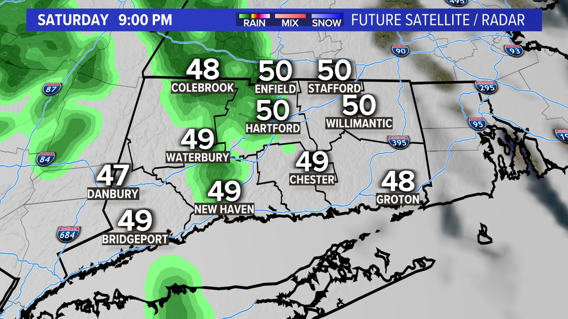
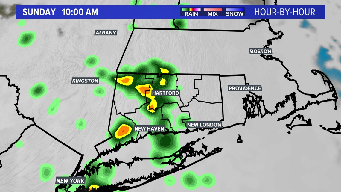
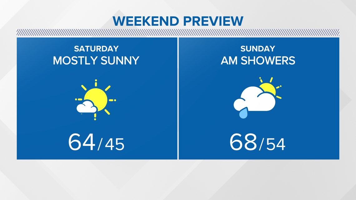
Although most of the weekend will be dry. There may be a few showers around Saturday night that linger into Sunday morning.

The showers on Sunday are associated with a warm front that will boost the temperatures next week.


Temperatures will be much warmer Monday and beyond!

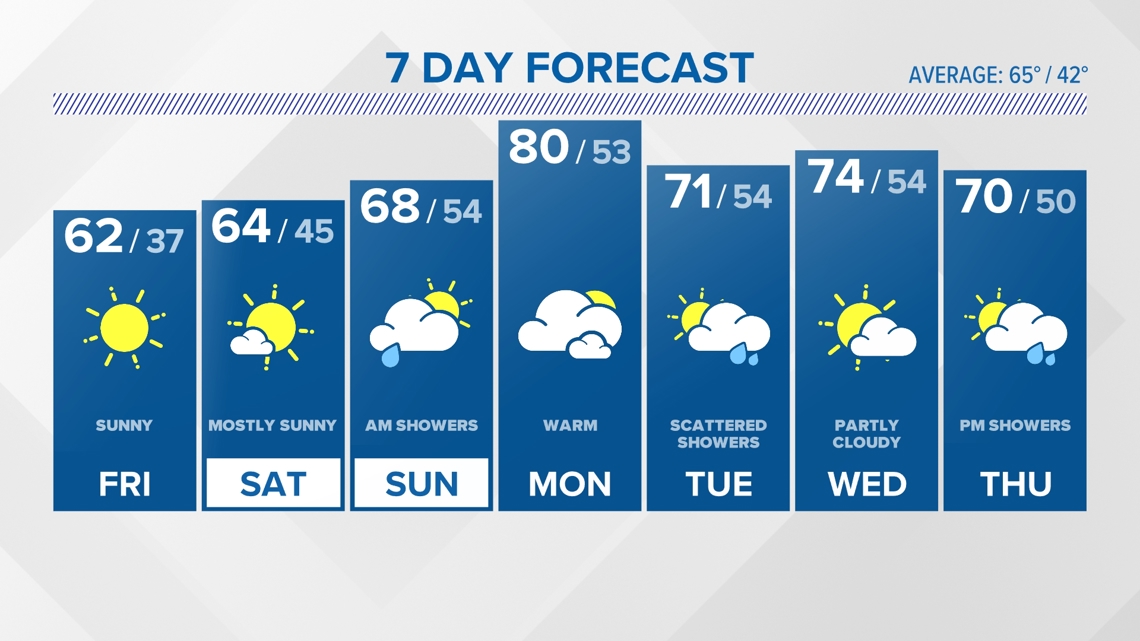
Forecast Details:
TONIGHT: Cold and clear. Freeze warning. Low: Near 30. 30s shore.
FRIDAY: Sunny and pleasant. A bit milder afternoon. High: Low 60s.
SATURDAY: Sunny to partly cloudy. High: Low-mid 60s.
SUNDAY: Morning showers. Drying out, partly to mostly cloudy in the afternoon. High: Upper 60s.
MONDAY: Partly cloudy, warm. High: Near 80.
TUESDAY: Scattered showers, thunder. High: Low 70s.
WEDNESDAY: Partly cloudy. High: Mid 70s.
Follow the FOX61 Weather Watch team on Facebook:
And on X (formerly known as Twitter):
Rachel Frank, Matt Scott, Sam Sampieri, Rachel Piscitelli, Ryan Breton
Watch More: Weather Watch